The welcome burst of springtime sun has brought with it gale-force winds to multiple Australian states and territories, triggering mass power outages for thousands.
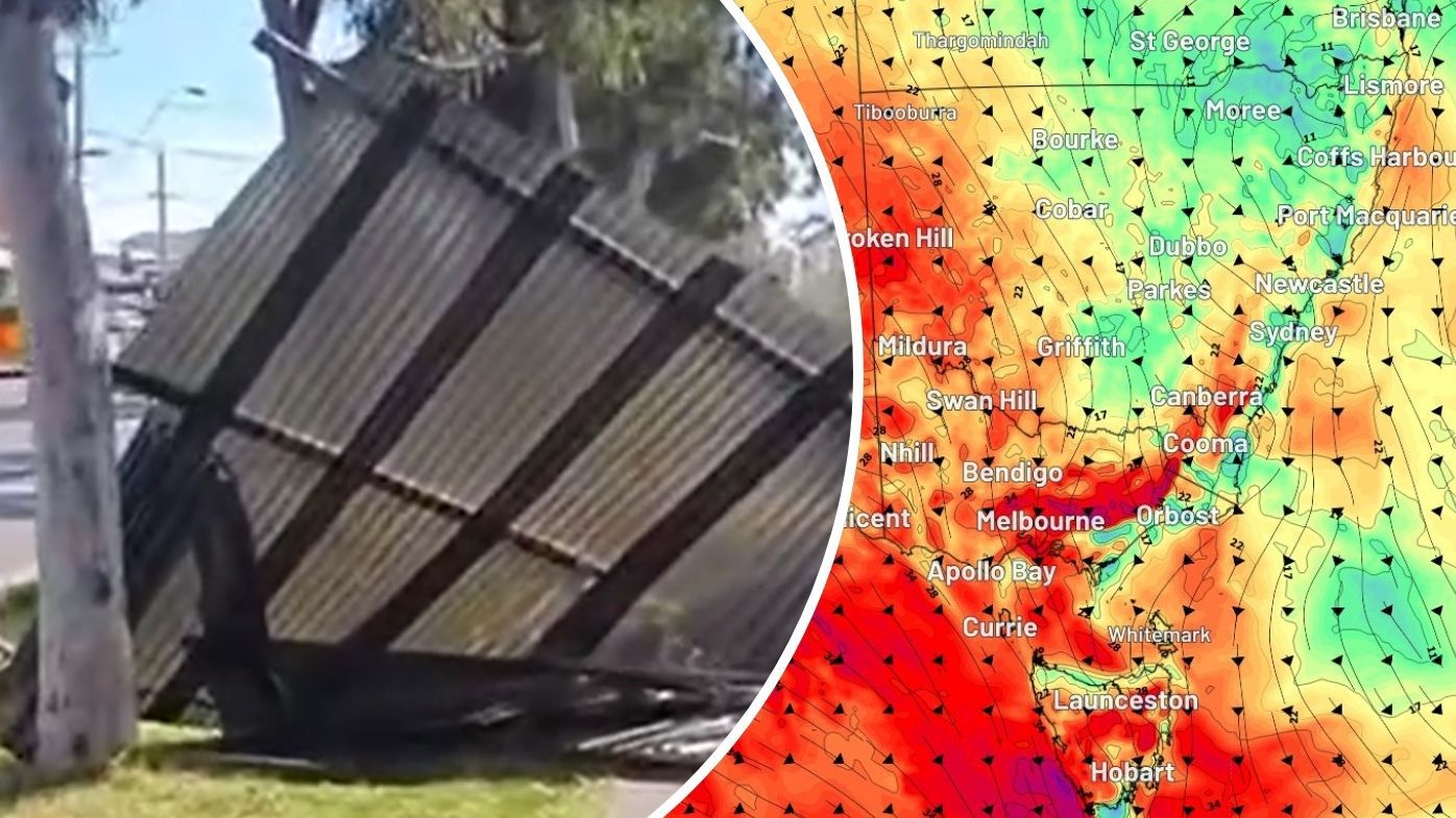
In Melbourne in particular it was a chaotic day, as wild winds wreaked havoc bringing down trees, and tearing roofs off homes.
The SES received more than 500 calls for help, with suburbs in the city’s north hardest hit.

One house in Heidelberg Heights had the roof ripped off while the airport recorded the strongest winds of more than 100km/h.
READ MORE: These siblings started a business with a few hundred bucks. It’s made $20 million
Trees were snapped in half, and at Reservoir, fences torn down while passengers on the Upfield and Hurstbridge lines had to be put onto replacement buses after fallen branches and building debris blocked the tracks.
By mid afternoon, power was also cut to more than 3000 properties.


That included Summerhill Road shops in Reservoir, where a number of businesses were forced to shut up shop with a few owners trying to press on despite the lights being out.
Damaging winds have eased in western and central Victoria but will continue in the east into Tuesday, the BOM said.
Winds have also died down in rural South Australia.
However, damaging winds are headed for parts of NSW and the ACT.
South Coast, Southern Tablelands, Snowy Mountains, Australian Capital Territory and South West Slopes Forecast Districts are under a warning.
Warnings remain in place for Tasmania including Western, Upper Derwent Valley, South East, Central Plateau and parts of North East, East Coast, Midlands, North West Coast and Central North Forecast Districts.
The surge of warm air has whipped up a windy frenzy before a cold front which is due to arrive tomorrow, Weatherzone reports.
READ MORE: Teacher who beat cancer killed in tragic jet ski accident


Warmer weather for most of the country
Springtime sun will wash across much of the land early this week in a break from repeated, successive cold fronts.
Sydney saw a top of 26 degrees today with sunny skies, rising towards 28 tomorrow, according to the Bureau of Meteorology.
Temperatures will sway between low and high 20s for the rest of the week, with possible showers on Friday and Saturday.
READ MORE: ‘Note’ left by Charlie Kirk shooting suspect under investigation

After today, temperatures in the Victorian capital will dip again, however, and rain will remain a possibility throughout the week.
A sunny Brisbane peaked at 25 today, but Wednesday is set to be the hottest day of the week with a top of 30 degrees.
READ MORE: Car mounts footpath, hits boy in alleged hit and run in Melbourne

There are possible showers forecast toward the end of the week.
Adelaide is running counter to most capitals with rain forecast throughout the week, but temperatures will plummet back to 17 degrees tomorrow.
Hobart in Tasmania will see temperatures remain below 20 for the rest of the week.
READ MORE: Rapper and alleged underworld member the target of Sydney shooting

Canberra also saw a high of 21 today compared to frostier temperatures and rain the rest of the week.
Darwin will remain at tops of 33 or 34 degrees all week.
Perth will reverse the trend of most capitals, starting out the week chilly and rainy with a top of 17 degrees today.
However, by the end of the week the WA capital has sunny tops of 26 degrees predicted.
DOWNLOAD THE 9NEWS APP: Stay across all the latest in breaking news, sport, politics and the weather via our news app and get notifications sent straight to your smartphone. Available on the Apple App Store and Google Play.