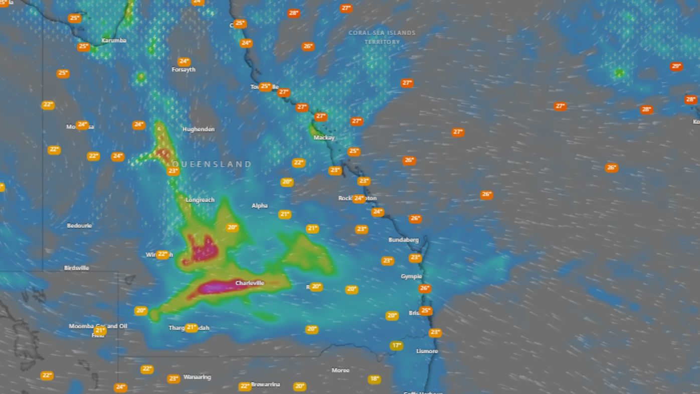
Parts of outback Queensland are bracing for downpours of 200mm in the next 24 hours as residents are warned to prepare for flash flooding.
Central Western and northern regions of the state are forecast to cop a further drenching today, with the extreme weather not expected to ease until tomorrow.
The Bureau of Meteorology issued a severe weather warning for much of the Central West and Channel Country in Queensland.
READ MORE: Olympic projects to be scrapped amid stadium backlash
“Through these large outback regions in Queensland 100mm is possible in the next 24 hours, and isolated locations in these areas could see up to 200mm,” senior meteorologist Angus Hines said.
The deluge began yesterday morning. Up to 5am AEST today, Paluma on the Far North Queensland coast recorded 124mm, while 121mm fell on Malboona in the Central West, and Quilpie in the Channel Country received 110mm.
Flood warnings have been issued for rivers across the central and western parts, but authorities are especially concerned about the risk of floodwaters from the Bulloo River, which has a major flood alert.
Communities which may be affected include Longreach, Quilpie, Windorah, Isisford, Barcaldine and Winton.
Conditions are expected to ease from tomorrow, but forecasters warn the big wet will continue into the weekend.
https://twitter.com/BOM_Qld/status/1904259546702319909?ref_src=twsrc%5Etfw
Nearly all parts of Queensland can expect falls of 50mm to 150mm.
But some outback regions are likely to receive up to 300mm, before conditions ease early next week.
Meanwhile, on the other side of the country, a late-season heatwave is continuing in Western Australia.
South-western parts of the state, including the capital Perth, will bask in maximum temperatures of 35 degrees or more for much of this week.
DOWNLOAD THE 9NEWS APP: Stay across all the latest in breaking news, sport, politics and the weather via our news app and get notifications sent straight to your smartphone. Available on the Apple App Store and Google Play.
