A 3000-kilometre rainband stretching over a large part of the nation could bring more rainfall to outback areas.
Forecasters are warning roads could be cut off at the end of the week, as the clean-up continues from the devastating NSW floods.
The rain is heading for northern Western Australia, the Northern Territory and parts of Queensland.
READ MORE: New Zealand teen dies after run it straight-style game
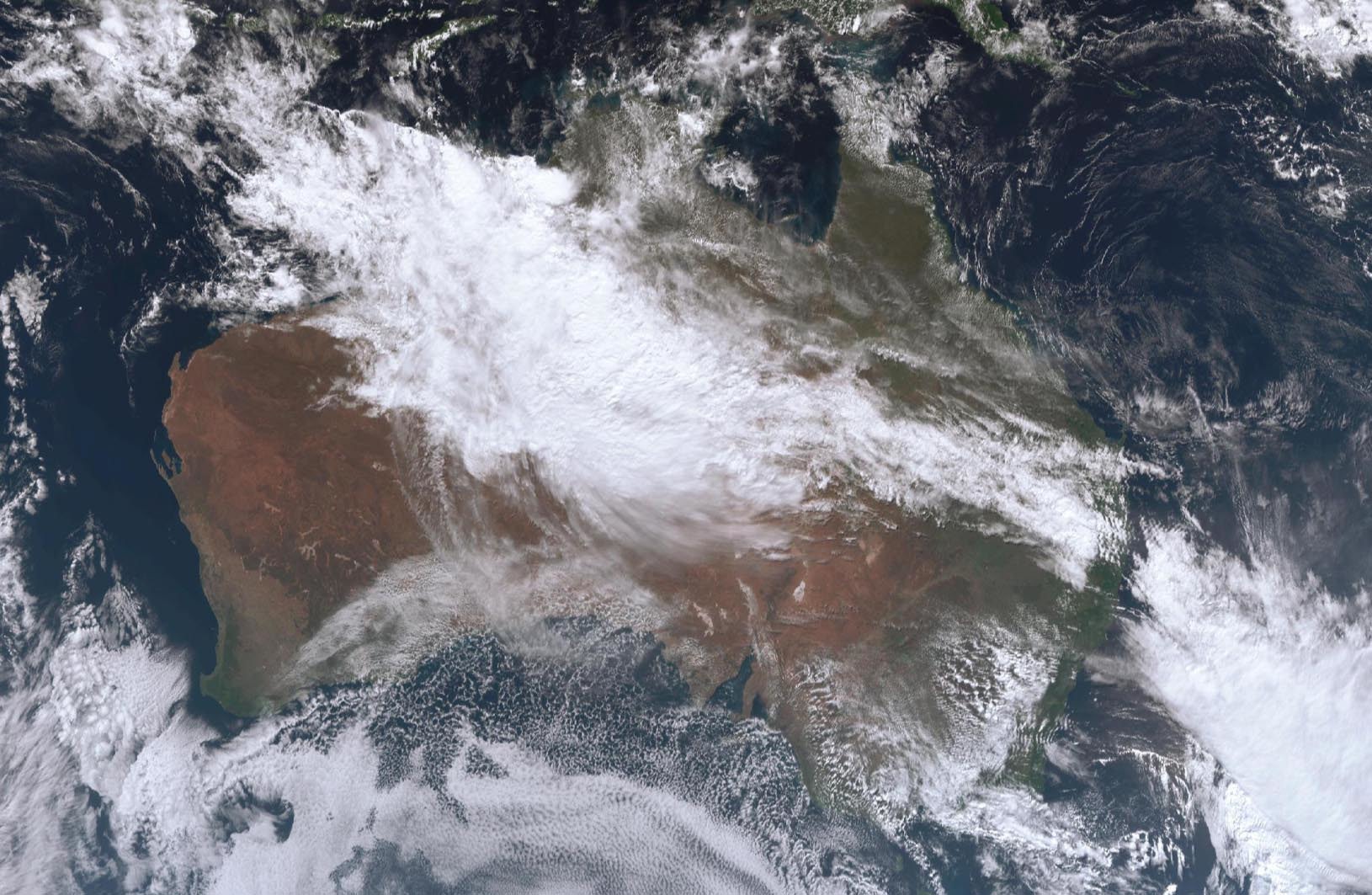
”While southern Australia is enduring a blast of wintry weather this week, parts of northern and central Australia will cop heavy rain from a big north-west cloud band,” Weatherzone said.
Meanwhile, the nation’s south-east is in for colder temperatures, with the mountains to see snow.
Adelaide has seen its heaviest rain for nine months today, Weatherzone said.
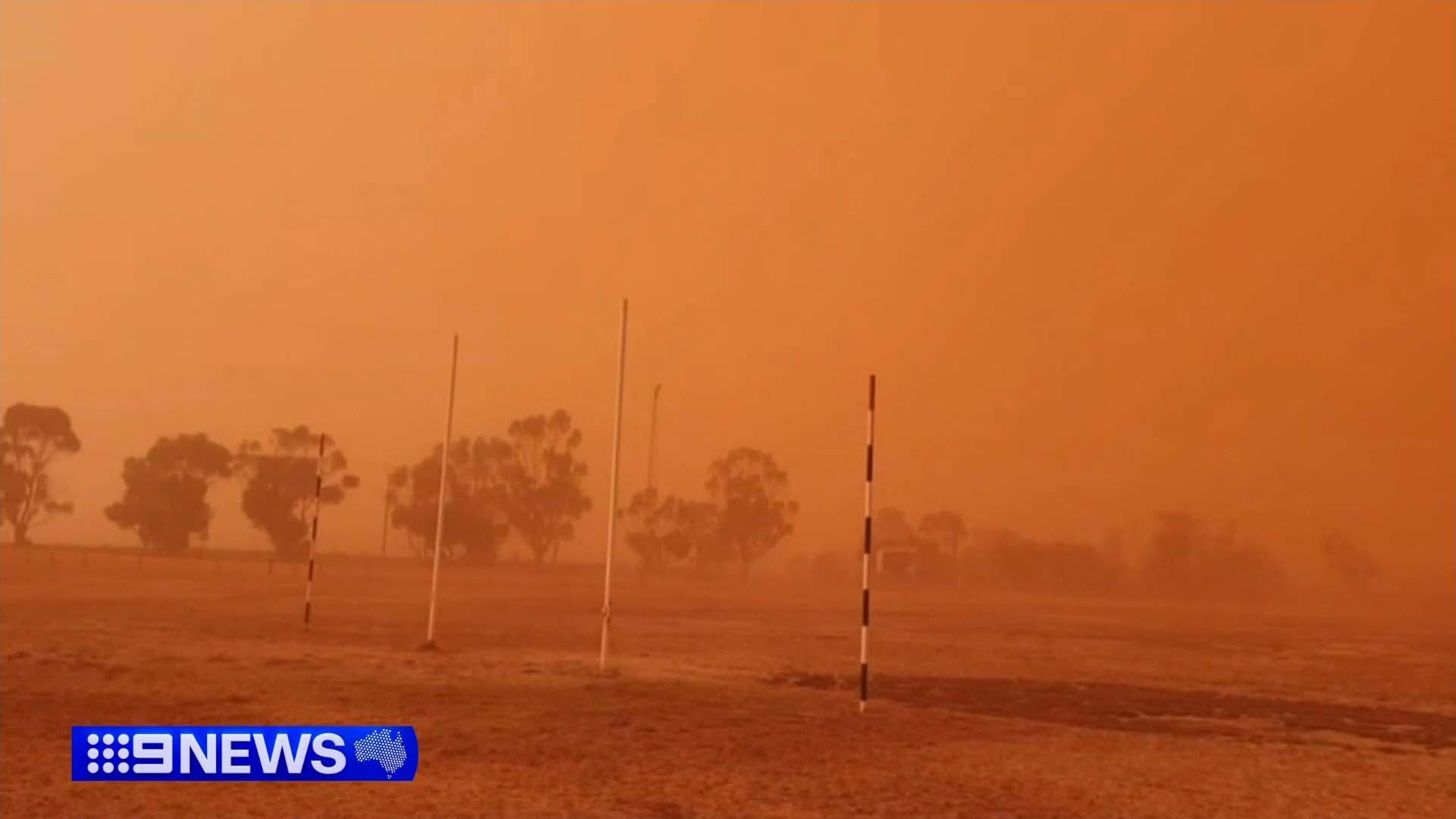
Warnings have been issued in Sydney after dust from wild winds in South Australia shrouded the city.
The air quality is classed as “very poor” in the city.

Wild winds hit millions
Winds of more than 120km/h were recorded as a cold front swept through southern Australia yesterday, with millions still in the firing line today.
Senior meteorologist with the Bureau of Meteorology, Dean Narramore, said there had been widespread “strong to damaging” winds in South Australia and Victoria, even reaching parts of southern NSW.
Gusts of 126km/h were recorded at Mount Hotham in Victoria, while winds also reached 115km/h at Thredbo in NSW, and 110km/h at Mount Buller and Falls Creek in Victoria.
READ MORE: Concerns for Sydney woman missing since last week
Metropolitan Melbourne recorded gusts of 60km/h to 80km/h.
Rain totals of 30mm to 50mm were recorded in Mount Lofty and the Adelaide Hills in South Australia.
READ MORE: Two charged with looting offences in flood-ravaged NSW town
Narramore said for some parts of the drought-hit state, yesterday would have been the wettest day since winter or early spring last year.
Falls were milder in Victoria, reaching 5mm to 15mm.
There are still a number of wind and high tide warnings for South Australia and Victoria, though conditions are expected to be milder and less widespread, and to clear up by the afternoon.
READ MORE: Four children among 27 in hospital after van crashes into UK crowd
NSW, however, will face widespread damaging winds today, including the flood-hit Mid North Coast and northern Hunter regions, as well as the Northern Tablelands, Illawarra, Blue Mountains, and South Coast.
Gusts up to and possibly exceeding 90km/h are expected.
Additionally, falls of 20mm to 40mm of rain have already been recorded for the already-drenched Hunter and northern NSW, but that will clear up by the afternoon.
Conditions are expected to ease through tonight to tomorrow.
People can stay up to date with the latest warnings and forecasts at the BoM website.
DOWNLOAD THE 9NEWS APP: Stay across all the latest in breaking news, sport, politics and the weather via our news app and get notifications sent straight to your smartphone. Available on the Apple App Store and Google Play.