As if three summer heatwaves were not enough for the good people of London and the south-east, a fourth is on the way.
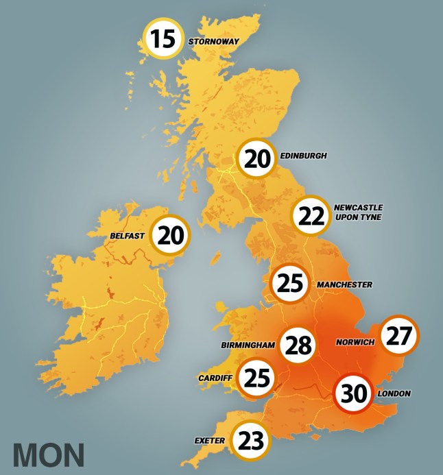
After a couple of weeks shivering in mid-twenties temperatures, parts of the country are expected to push up to 30°C and even higher today.
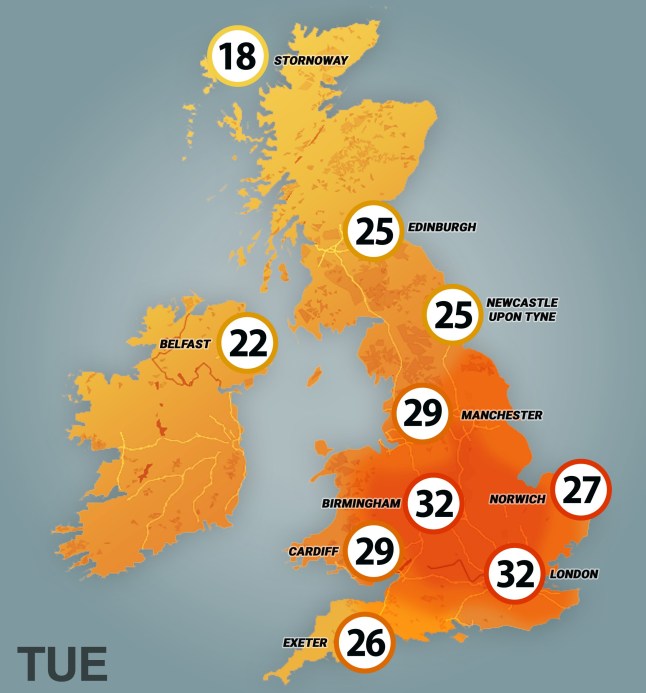
According to the Met Office, the peak of this latest bout of sweltering weather will hit tomorrow with areas like London, the West Midlands and Buckinghamshire hitting the mid-thirties.
The forecasters don’t toss around the term ‘heatwave’ lightly: to become official, a temperature threshold must be exceeded for three days in a row.
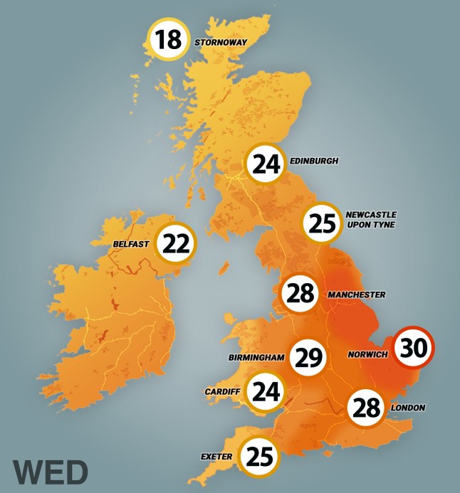
They’re predicting that criteria will be hit with a further day of blazing sun on Wednesday.
Sign up for all of the latest stories
Start your day informed with Metro’s News Updates newsletter or get Breaking News alerts the moment it happens.
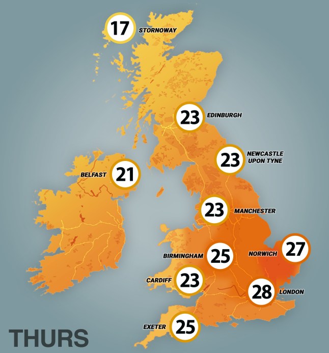
Our maps show where in the country the heat will be concentrated over the next few days.
On top of this, public health officials have issued an amber heat health alert for the East Midlands, West Midlands, East of England, London, and the South East.
The notice, in effect from tomorrow until Wednesday, says the heat will likely lead to a ‘rise in deaths’ among more vulnerable, elderly groups.
A yellow weather alert has been issued for the rest of the UK, which states a rise in deaths are ‘possible’, as are strains to health services.
Tom Crabtree, a chief meteorologist at the Met Office, said: ‘Warmth is the focus in the forecast in the first half of this week, with temperatures likely to peak on Tuesday around the mid-30s, but remaining above average in the second half of the week, particularly further to the southeast.’
There’s usually an exception to the roasting weather, and in this case it’s the people of north-west Scotland bearing the brunt.
Showers are expected to hit the area throughout Monday, meaning they will have to wait until tomorrow for the mercury to hit the mid to high twenties.
Or from a different angle, southerners who are sick of the heat can pop up to beautiful Applecross or Torridon for some sweet relief today.
Hot weather is often served up with a side of thunder and lightning and this week is likely to be no different.
Tom said: ‘While there’s a fair degree of uncertainty at this range, the main signal for more frequent thundery showers arrives from the south late on Wednesday and into Thursday.
‘The risk of showers spreads north and west on Thursday, potentially bringing some fairly wet weather to Scotland, northwest England and parts of Wales through the day.’
Rising temperatures around the British Isles are also drawing in more unusual visitors to our seas.
According to the BBC, the average surface temperature of waters around the UK up to the end of July was 0.2°C hotter that any other year since 1980.
This has led to creatures not normally seen off our coasts coming to explore, including octopus, bluefin tuna and a jellyfish called a mauve stinger.
Get in touch with our news team by emailing us at webnews@metro.co.uk.
For more stories like this, check our news page.